Mapping neighborhood scale survey responses with uncertainty metrics
Keywords:
demography, data uncertainty, inequity analysis, spatial-temporal application credibility, planning analysis, survey analysisAbstract
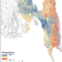
This paper presents a methodology of mapping population-centric social, infrastructural, and environmental metrics at neighborhood scale. This methodology extends traditional survey analysis methods to create cartographic products useful in agent-based modeling and geographic information analysis. It utilizes and synthesizes survey microdata, sub-upazila attributes, land use information, and ground truth locations of attributes to create neighborhood scale multi-attribute maps. Monte Carlo methods are employed to combine any number of survey responses to stochastically weight survey cases and to simulate survey cases' locations in a study area. Through such Monte Carlo methods, known errors from each of the input sources can be retained. By keeping individual survey cases as the atomic unit of data representation, this methodology ensures that important covariates are retained and that ecological inference fallacy is eliminated. These techniques are demonstrated with a case study from the Chittagong Division in Bangladesh. The results provide a population-centric understanding of many social, infrastructural, and environmental metrics desired in humanitarian aid and disaster relief planning and operations wherever long term familiarity is lacking. Of critical importance is that the resulting products have easy to use explicit representation of the errors and uncertainties of each of the input sources via the automatically generated summary statistics created at the application's geographic scale.
Downloads
Published
Issue
Section
License
Copyright (c) 2016 Charles Robert Ehlschlaeger, Yizhao Gao, James D. Westervelt, Robert C. Lozar, Marina V. Drigo, Jeffery A. Burkhalter, Carey L. Baxter, Matthew D. Hiett, Ellen R. Hartman

This work is licensed under a Creative Commons Attribution 4.0 International License.
Articles in JOSIS are licensed under a Creative Commons Attribution 3.0 License.
