Routes visualization: Automated placement of multiple route symbols along a physical network infrastructure
Keywords:
automated cartography, routes map, symbol placement, constraints formulation, constraints optimisation problem, simulated annealingAbstract
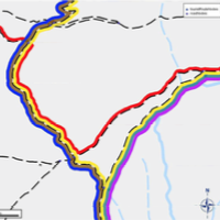
This paper tackles the representation of routes carried by a physical network infrastructure on a map. In particular, the paper examines the case where each route is represented by a separate colored linear symbol offset from the physical network segments and from other routes—as on public transit maps with bus routes offset from roads. In this study, the objective is to automate the placement of such route symbols while maximizing their legibility, especially at junctions. The problem is modeled as a constraint optimization problem. Legibility criteria are identified and formalized as constraints to optimize, while focusing on the case of hiking routes in a physical network composed of roads and pedestrian paths. Two solving methods are tested, based on backtracking and simulated annealing meta-heuristics respectively. Encouraging results obtained on real data are presented and discussed.
Downloads
Published
Issue
Section
License
Copyright (c) 2015 Jules Teulade-Denantes, Adrien Maudet, Cécile Duchêne

This work is licensed under a Creative Commons Attribution 4.0 International License.
Articles in JOSIS are licensed under a Creative Commons Attribution 3.0 License.
