Mapping uncertain spatial object extents from point samples using fuzzy alpha-shapes
DOI:
https://doi.org/10.5311/JOSIS.2023.26.254Keywords:
bias, biogeography, entities, error, geographic, geometry, range, region, speciesAbstract
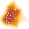
Mapping the extent of spatial objects from point samples is a fundamental process in geographical analysis. Computational geometry methods are commonly used, and one method that has been proposed is the alpha-shape as it is insensitive to both bias and errors that are common in crowdsourced geographic data and big geographic data more generally. However, many spatial objects are uncertain in nature, with vague boundaries that are not well represented by the current use of discrete alpha-shapes. Fuzzy alpha-shapes are presented as a highly generic and adaptable methodology that can produce maps of spatial objects that recognise the vague and uncertain nature of many geographies. A series of virtual geography experiments demonstrate that fuzzy alpha-shapes avoid the need for binary thresholds, create a model that better represents the uncertain boundaries of some spatial objects, while also retaining the robustness to errors and bias that motivated the original use of alpha-shapes for mapping spatial objects.
Downloads
Published
Issue
Section
License
Copyright (c) 2023 Thomas Etherington

This work is licensed under a Creative Commons Attribution 3.0 Unported License.
Articles in JOSIS are licensed under a Creative Commons Attribution 3.0 License.
