Modeling walkability by remote sensing as latent walking speed extracted from multiple digital trail maps
DOI:
https://doi.org/10.5311/JOSIS.2022.25.204Keywords:
digital trails, gpx, recommender system, SVD, search and rescue, DSSAbstract
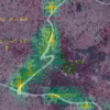
Coordinating and managing teams searching for missing persons in wilderness areas is challenging. Local terrain characteristics and environmental conditions strongly influence how searchers accomplish their search tasks. When making decisions, searchers consult various maps of the area. In this paper we proposed a methodology for mapping characteristics of the area that influence user behavior when walking the area, and define a walkability model of the terrain. We define walkability as a measure of how fast a person can walk through terrain. The observed walking speed depends on factors such as the fitness and motivation of a person walking through the terrain, as well as on assistive features and the configuration of the terrain. In our method, walkability is predicted only as a feature of terrain configuration. We used singular value decomposition (SVD) to transform datasets to extract latent features of the terrain and users from multiple Global Positioning System (GPS) trails. We define the walkability measure as a latent component of walking speed, which is a function of terrain features. Finally, we use a polynomial regression algorithm to build a model for predicting terrain walkability based on remote sensing imagery from the Sentinel-2 mission. The application of the proposed model is demonstrated in the Kozjak mountain region in the Republic of Croatia.
Downloads
Published
Issue
Section
License
Copyright (c) 2022 Ljiljana Šerić, Marina Tavra, Ivan Racetin, Antonia Ivanda

This work is licensed under a Creative Commons Attribution 3.0 Unported License.
Articles in JOSIS are licensed under a Creative Commons Attribution 3.0 License.
